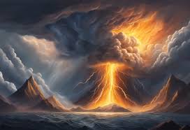
Natural disasters are among the most powerful and terrifying events on Earth. From towering tsunamis to devastating earthquakes and monstrous hurricanes, these forces of nature can reshape landscapes, destroy entire communities, and alter the course of human history. But behind the destruction lies a fascinating realm of science—mechanisms and systems that govern how, why, and when these events occur.
Understanding the science of natural disasters not only satisfies our curiosity about Earth’s dynamic behavior but also helps scientists and governments develop better tools to prepare for and reduce their impact. In this article, we’ll explore the core types of natural disasters, their underlying causes, and how science is helping us better predict and respond to them.
What Is a Natural Disaster?
A natural disaster is a sudden, catastrophic event caused by natural processes of the Earth. It results in significant damage or loss of life. While some natural events like earthquakes or floods are inevitable, they become “disasters” when they impact human life or infrastructure. Not all natural hazards lead to disasters—but when they intersect with human settlements, the results can be devastating.
Natural disasters fall into several categories: geological (earthquakes, volcanoes, landslides), meteorological (hurricanes, tornadoes, blizzards), hydrological (floods, tsunamis), and biological (epidemics, infestations). Each has a distinct scientific cause rooted in Earth’s systems.
Earthquakes: Movement Beneath Our Feet
Earthquakes are caused by the sudden release of energy in Earth’s crust, usually due to movement along fault lines. The Earth’s outer shell, or lithosphere, is made up of large tectonic plates that float on a layer of molten rock known as the mantle. These plates are constantly shifting, though the motion is usually imperceptible.
When stress builds up along plate boundaries and exceeds the friction holding them in place, the plates suddenly slip. This rapid movement releases energy as seismic waves, which shake the ground. The point on the surface directly above the quake’s origin (the focus) is called the epicenter.
Seismologists use tools like seismographs and GPS sensors to monitor tectonic activity and assess earthquake risk. However, predicting exactly when and where an earthquake will strike remains one of science’s greatest challenges.
Volcanoes: Earth’s Fiery Vents
Volcanoes are openings in the Earth’s crust where magma (molten rock) rises to the surface. They typically form at tectonic plate boundaries, especially where plates are colliding (subduction zones) or pulling apart (divergent boundaries). When pressure from underground magma builds up, it can lead to explosive eruptions.
These eruptions can eject ash, gases, and lava, sometimes with devastating effects on nearby communities. Some volcanoes, like Mount St. Helens in the U.S. or Mount Vesuvius in Italy, have become infamous for their deadly eruptions.
Volcanologists study gases, seismic activity, and ground deformation to assess eruption risks. Unlike earthquakes, volcanic eruptions are often preceded by warning signs, allowing authorities to evacuate people in time.
Tsunamis: Waves Born from the Deep
Tsunamis are massive ocean waves typically caused by underwater earthquakes, volcanic eruptions, or landslides. When a sudden movement occurs on the ocean floor, it displaces a huge volume of water. That energy travels across the sea at high speeds—up to 500 mph—though the waves may only be a few feet high in the open ocean.
As the tsunami approaches shallower waters near the shore, the wave slows down and increases dramatically in height, sometimes reaching over 100 feet. Tsunamis can flood coastlines, destroy structures, and lead to significant loss of life.
Early warning systems use underwater sensors and satellite data to detect potential tsunami activity. Countries in tsunami-prone regions often conduct evacuation drills and maintain siren systems along the coast.
Hurricanes and Cyclones: Nature’s Rotating Powerhouses
Hurricanes, typhoons, and cyclones are essentially the same storm system—massive, rotating tropical storms that form over warm ocean waters. These storms draw energy from the heat of the ocean, forming an organized system of clouds, wind, and rain.
A hurricane forms when warm, moist air rises and begins to spin due to Earth’s rotation (the Coriolis effect). As the storm grows, it develops an eye at its center, surrounded by an eyewall where winds are strongest—often exceeding 150 mph.
Climate scientists believe global warming may be intensifying tropical storms, making them more frequent and severe. Satellite imagery, ocean buoys, and aircraft-based radar systems help meteorologists track hurricanes and issue timely warnings.
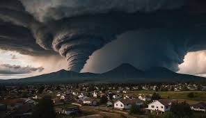
Tornadoes: Twisting Funnels of Destruction
Tornadoes are violently rotating columns of air that extend from thunderstorms to the ground. They form when warm, moist air meets cool, dry air—often in the central United States, famously known as “Tornado Alley.”
The contrasting air masses create instability and wind shear (changes in wind speed and direction), which can cause the storm to rotate. If the rotation intensifies and stretches vertically, it can form a tornado.
Tornadoes can cause extreme damage over narrow paths, sometimes destroying buildings in seconds. The Enhanced Fujita (EF) scale rates them from EF0 to EF5 based on wind speed and damage potential.
Advancements in Doppler radar and storm-chasing research have improved warning times, but tornadoes can still strike with little notice.
Floods and Droughts: Opposite Extremes, Same Impact
Floods occur when water overflows onto normally dry land. This can happen from heavy rains, storm surges, or dam failures. Urban areas with poor drainage are especially vulnerable.
Droughts, on the other hand, are prolonged periods of little to no rainfall. They may not seem as dramatic as other disasters but can have long-lasting effects on agriculture, ecosystems, and water supplies.
Both extremes are influenced by climate patterns like El Niño and La Niña. Scientists use satellite data and climate models to monitor changes and issue forecasts.
Climate Change and Natural Disasters
There is growing evidence that climate change is influencing the frequency and severity of many natural disasters. Warmer ocean temperatures are fueling stronger hurricanes, while rising sea levels increase the risk of coastal flooding. Changes in precipitation patterns contribute to more intense droughts and floods.
Scientists are using complex computer models to simulate future climate scenarios. These models help policymakers plan infrastructure, manage resources, and create early warning systems to protect vulnerable communities.
Can Natural Disasters Be Predicted?
While some disasters, like hurricanes and volcanoes, offer some warning signs, others—such as earthquakes—remain unpredictable. Scientists are making progress using artificial intelligence, big data, and global sensor networks to improve prediction capabilities.
For example:
- Seismic networks monitor plate movement in real-time.
- Volcano observatories detect gas emissions and ground deformation.
- Climate models simulate future storm patterns.
- Tsunami buoys alert coastal regions within minutes of an underwater quake.
Preparedness is just as important as prediction. Emergency drills, education, and resilient infrastructure are key components of disaster risk reduction.

The Human Element: Reducing the Impact
Though we can’t prevent natural disasters, we can reduce their impact. Engineering advancements, such as earthquake-resistant buildings and flood barriers, save lives. Public education campaigns teach people how to respond in emergencies.
Global cooperation is also vital. Organizations like the UN and Red Cross coordinate disaster response, while scientists across borders share data and expertise.
Investment in early warning systems, research, and climate adaptation is essential for building a safer future.
Conclusion: Earth’s Raw Power, Explained
Natural disasters are reminders that Earth is an active, ever-changing planet. Beneath the destruction lies an intricate system of tectonic plates, atmospheric currents, and oceanic forces—each obeying the laws of physics and chemistry.
The science of natural disasters not only helps us understand these events but also empowers us to prepare for them. With technology, research, and global cooperation, we can better predict, respond to, and recover from Earth’s most powerful phenomena.
By respecting nature’s power and embracing the science behind it, we give ourselves the best chance to coexist with a planet that is both nurturing and unpredictable.
Read more:https://nfds.xyz/wp-admin/post.php?post=124&action=edit